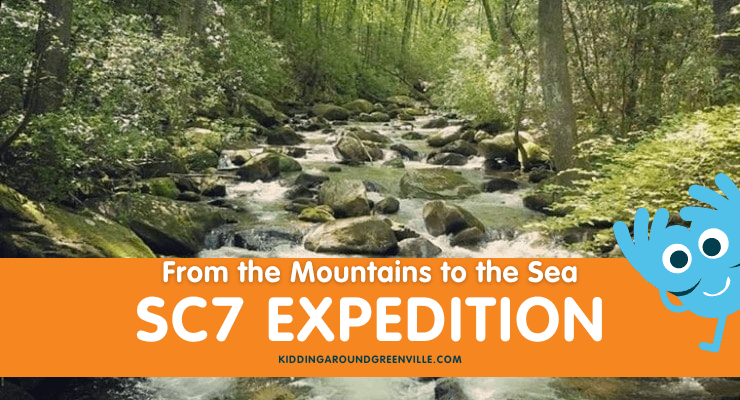
The SC7 Expedition is once again exploring the state from the mountains to the sea, this year in April and May 2024! The name South Carolina 7 represents seven natural wonders in our state, including National Geographic-recognized ecological areas and historical sites such as the Jocassee Gorges, Sassafras Mountain, and the Chattooga River.
Kidding Around covered this epic month-long event in 2021; you can find everything about that year’s route in our article South Carolina’s Top 30 Beautiful Natural Spots! This year the team is following a similar path across the state, with a few new locations – including several in the Upstate.
Have you visited South Carolina’s ACE Basin in the Lowcountry? Ever wondered what the ACE Basin is? Or maybe you just want to know more about this ecologically unique area that checks all the boxes for a fantastic weekend? Keep reading to find out what the ACE Basin is and how best to see it!
Edisto Spanish Mount Shell Midden
What is South Carolina’s ACE Basin?
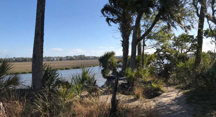
Three rivers – the Ashepoo, the Combahee and the Edisto (ACE) – come together at St. Helena Sound in South Carolina’s Lowcountry to form a rich estuary. This 350,000-acre ACE Basin watershed contains one of the largest areas of undeveloped wetlands/uplands ecosystems remaining on the Atlantic Coast and features a remarkable interlocking web of ecosystems including forested uplands, wetlands, tidal marshes, barrier islands, and peatlands.
According to The Nature Conservancy, it supports 33 types of natural plant communities and provides critical habitat for waterfowl, migratory birds and endangered species. In 2014, National Geographic featured the ACE Basin as its cover story, and The Nature Conservancy has declared the area “one of the last great places.”
From the early 1700s to the mid-1800s, much of the ACE Basin was home to large plantations that primarily grew rice. In the late 1800s, many of these plantations were purchased by wealthy sportsmen as hunting retreats, who managed the former rice fields and adjacent upland estates for a wide range of wildlife – ensuring that the region remained relatively undeveloped.
Sounds cool! But how can we see it?: How to Visit ACE Basin
The principal road through the ACE Basin is U.S. Highway 17, the ACE Basin Parkway, which skirts the north end of the protected areas connecting Charleston to Yemassee. Small communities within ACE Basin include Bennetts Point, Green Pond, Jacksonboro, Wiggins and Willtown Bluff.
There are numerous access points to the public lands of the ACE Basin including 23 boat landings, allowing visitors opportunities to experience it by land and by water!
Edisto Learning Center & Edisto Beach State Park
A good place to start is at Edisto Beach State Park. The park’s environmental education center is a “green” building with exhibits that highlight the natural history of Edisto Island and the surrounding ACE Basin. One of four oceanfront state parks in South Carolina, it features trails for hiking and biking in addition to the 1.5 miles of beach renowned for its shelling.
Edisto Beach State Park is also an excellent home base for additional ACE Basin explorations; if camping or staying at a cabin there, you are within an easy drive of the Edisto River side of the region including ACE Basin National Wildlife Refuge and Botany Bay!
Dawhoo Bridge view
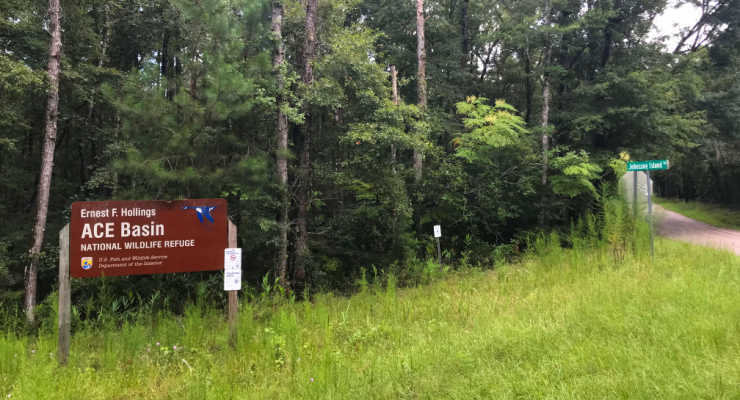
ACE Basin National Wildlife Refuge
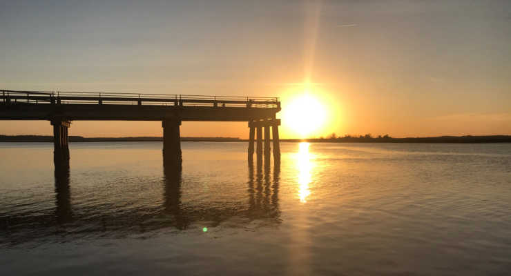
Driving north from Edisto Beach there is a boat ramp at the Dawhoo Bridge that offers westerly views (great for sunset viewing!) over the salt marsh and towards Ernest F. Hollings ACE Basin National Wildlife Refuge. At just under 12,000 acres, the Refuge is key in protecting the Edisto portion of the estuary.
In addition, the Refuge office is a former rice plantation house that was built in 1828, one of only a few antebellum mansions that survived the civil war in the area; today it is protected on the National Register of Historic Places.
You can visit both Grove Plantation House and the kitchen house. The Visitor’s area inside the Plantation House has tons of information for you.
There are a variety of recreational activities such as hunting (in season), picnicking, hiking, fresh and saltwater fishing, canoeing, wildlife watching, photography, and environmental education. Special events and programs are held throughout the year for visitors to learn more about the ACE Basin and National Wildlife Refuges; see the Fish & Wildlife Service website.
Botany Bay
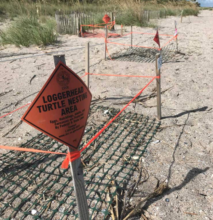
The 3,363 acre Botany Bay Plantation Wildlife Management Area (WMA) is located in the northeast corner of Edisto Island, and is important to numerous wildlife species including the federally-threatened loggerhead sea turtle and the state-threatened least tern.
Cultural sites including the Fig Island Shell Rings, outbuildings from Bleak Hall Plantation and elements of the Alexander Bache U.S. Coast Survey Line – all listed on the National Register of Historic Places.
The causeway to the beach is wheelchair accessible, and the designated driving tour provides excellent viewing opportunities for the mobility impaired; for more information, please visit the SC DNR website.
Edisto River & State Parks
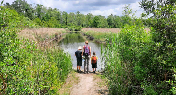
A great way to see the Edisto River is from kayak or canoe. For more on the Edisto River Canoe and Kayak Trail, Edisto River Adventures tubing, and the two SC State Parks that provide access to the Edisto (Givhans Ferry and Colleton).
The blackwater river is the longest of its kind in North America and is a favorite for cooling down on hot summer days.
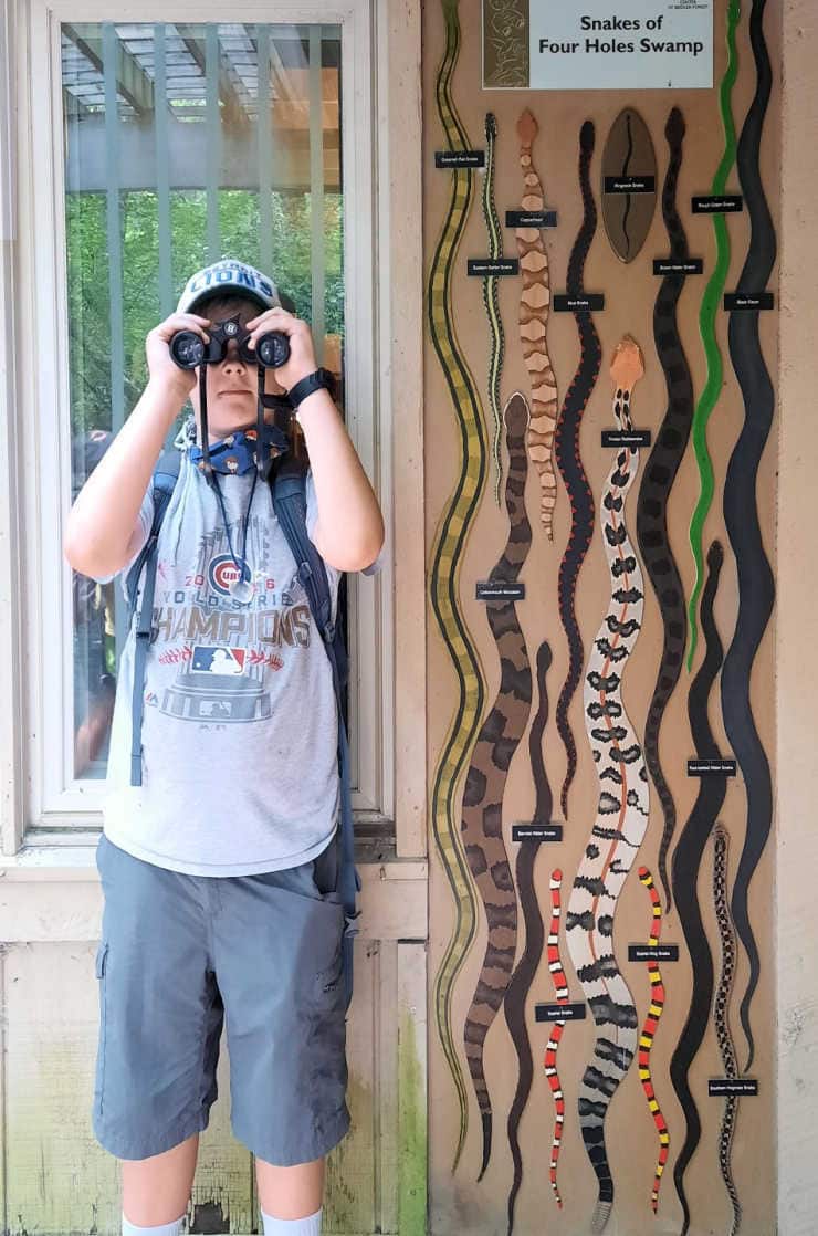
A portion of the headwaters of the Edisto River and ACE Basin is Four Holes Swamp, which visitors can experience through Audubon’s Beidler Forest. T
his 18,000-acre bird and wildlife sanctuary in the South Carolina Lowcountry is the world’s largest virgin cypress-tupelo swamp forest, home to thousand-year-old trees and a wide range of wildlife.
It is a great place to visit for families, as the entire 1.75-mile trail is a boardwalk: easy to follow, and provides safe viewing of wildlife without getting muddy or wet.
Ravenel Caw Caw Interpretive Center
This nature center has over six miles of walking trails that wind through its diverse habitats, with interpretive exhibits, displays, and an assortment of programs. Boardwalks take visitors through the wetlands and rice fields dating to the eighteenth century.
Caw Caw is a birding hotspot for coastal SC, but is also important historically: it’s one of the important sites of the Stono Rebellion, a Member of the National Park Service’s National Underground Railroad Network to Freedom Program, and features thousands of naturalized tea plants from a 20th-century tea farm.
On your visit, you can expect to see American alligators, swallow-tailed kites, and bald eagles! Admission is $2/person, for more information see the Charleston County Parks website.
Bear Island Game Management Area
It was a hot day in July when we found ourselves turning off Highway 17 towards Bennetts Point a few weeks ago. Much like many of the destinations on this side of Charleston – Edisto Beach, Hunting Island, Hilton Head – there is a significant drive from the main highway to reach the ocean.
Over the next 15 miles we wound our way along live oak-shaded lanes, the giants draped in Spanish moss functioning almost as curtains to the lands beyond. After crossing the Ashepoo River we entered Bear Island Game Management Area home to countless waterfowl and protected species such as wood storks and bald eagles.
The miles of dikes on Bear Island provide plenty of wildlife viewing, hiking, biking and hunting opportunities.
ACE Basin National Estuarine Research Reserve
Soon after passing Bear Island we arrived at the Michael D. McKenzie Field Station. Headquarters for the ACE Basin National Estuarine Research Reserve (NERR), the field station serves as a community hub for coastal science, education and collaboration.
The NERR encompasses nearly 100,000 acres of ACE Basin, and is managed in a joint effort by the South Carolina Department of Natural Resources (SC DNR) and the National Oceanic and Atmospheric Association (NOAA).
Adjacent Mosquito Creek was living up to its name, but luckily we were able to escape the insects by boarding a boat and heading out on the Ashepoo River as part of the South Carolina 7 expedition.
Viewing the ACE Basin from the water is an excellent way to not only get away from the bugs but also to get a feel for the enormity of coastline and estuary protected by the NERR and other entities.
There are numerous science, education and training programs operated by the SC DNR out of the field station including ones off and on the water; the facility contains offices, wet/dry labs, a conference room and an outdoor classroom, while science-related school groups and naturalists visit the field station for a variety of educational outdoor activities.
For more on the programs and workshops offered, please visit the ACE Basin NERR website.
Our boat tour with the SC7 team included an orientation to the ACE Basin watershed, and contained a look at the oyster reefs, plenty of wildlife viewing, and discussions of salt marsh and estuarine diversity.
For those wishing to tour the ACE Basin by boat, but looking for an option other than the NERR, a number of outfitters in Charleston, Beaufort and Colleton counties offer guided kayaking trips on the three rivers, as well as tours for those who prefer to enjoy the scenery from the comfort of a motorboat.
Islands only accessible by boat!
If traveling by water in the area, you more than likely will pass through or near the St. Helena Sound Heritage Preserve, a collection of coastal and barrier islands only accessible by boat. Otter Island is part of this Heritage Preserve, and receives special protection because of its significance for rare plants, threatened and endangered species, and as a historic site.
With developed islands to the north (Edisto) and to the south (Harbor, Fripp and Hunting), Otter Island is the only spot where wildlife species can rest, feed and reproduce without development pressures for a long stretch of coastline. Another barrier island only accessible by boat but providing ample wildlife viewing is South Fenwick Island.
Donnelley Wildlife Management Area
Heading back out from Bennetts Point you’ll pass the 8,000-acre Donnelley Wildlife Management Area just as you reach ACE Basin Parkway (Highway 17). The nature trails here offer birdwatching, hiking, biking, riding and hunting opportunities; check the website for seasonal closure information, as the WMA is closed during certain hunt periods.
When should we visit ACE Basin?
As anyone who has spent time in the Lowcountry knows, each season down near the coast comes with advantages and hindrances. Summer days can be hot and buggy, especially in the marsh, however a hot August day might just be perfect for tubing the Edisto or enjoying the ocean surf.
Spring and fall offer excellent birdwatching, cooler temperatures and fewer bugs, but some areas might see closures for hunt seasons. And while winter might mean you have the trail/boardwalk to yourself, it also brings cold & unpredictable weather…
As with any trip, planning ahead can really pay off in terms of knowing what to expect and what adjustments might have to be made. Our year-round basics include protection against the weather & insects, water and snacks, and comfortable clothes & footwear.
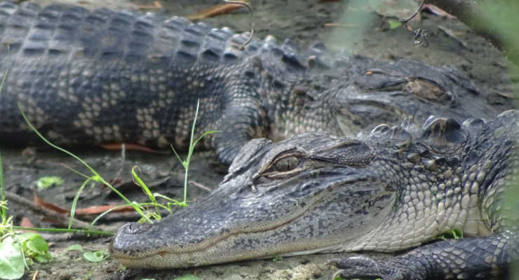
But snakes, alligators, and spiders?!
Before we took our boys tubing on the Edisto, I asked how often they see alligators on that stretch of the river – the answer was never. However, if you are kayaking the Four Holes Swamp, chances are you might see one or two. In any case, the key is to follow the basic guidelines as you would with all animals – keep your distance and don’t feed or harass the wildlife.
For our family, the fear of encountering the animals that get all the bad press has slowly turned to hopes of catching a glimpse of one of them: a gator from a causeway as we head out to one of the barrier islands, a snake from the safety of the boardwalk at Francis Beidler Forest, or a shark feeding out beyond the break as we sit safely on the shore of Edisto Beach.
Know what to do in case you come across a venomous snake, and know how to tell the difference between the ones that can hurt you and the harmless ones that help keep the rodent population in check.
And finally, stay on the trail, be mindful of where you are stepping, and exercise caution when out in the wilderness; animals are a part of the outdoor experience, and will add so much to your ACE Basin adventure!
Something for everyone!
More than 130,000 acres of land have been protected through public/private partnerships in the heart of the ACE Basin, qualifying it as one of the most acclaimed freshwater natural areas found on the East Coast.
It is open to hiking, biking, boating, driving, riding, diving, viewing, and tasting (we enjoy stopping at local stands for fresh produce and seafood – but that’s a whole other post!)… Each time we visit, we discover another thing we love about the area, and I hope this article has inspired you to visit the ACE Basin and find something of your own to love.
Have you visited Newberry, SC? Recently named one of the “Most Charming Small Towns in America” by Travel Channel, this historic town offers museums, art, hiking, and more! Newberry has continuously been selected as one of the South Carolina 7 Expedition stopping points because of its natural splendor and gorgeous Japanese garden. As a KAG SC7 correspondent, Liene Kukainis joined the team on the trail to see what all the press is about!
About Historic Newberry, SC
At the very heart of downtown is the Newberry Opera House. Completed in 1882, the Opera House was designed as a place of entertainment for locals and as a seat of government for the city – including a fire engine room and three jail cells! Silent pictures were slowly replaced by movies, and in the 1920s it was renovated as a movie theater. But in 1952 the movie theater closed, and there was even talk of tearing it down; luckily the Newberry Historical Society stepped in, and in 1970 the building was placed on the National Register of Historic Places. In 1998, the Newberry Opera House was reopened for performances after extensive renovations.
However, in 2010 downtown Newberry was struggling in the wake of the large national recession. When the City took steps to begin a revitalization of downtown, to make it more pedestrian-friendly and welcoming to visitors, the Opera remained at the center of it all. The location between the Greenville-Spartanburg corridor and Columbia makes it one of only a few venues in the Midlands/Piedmont, and musicians coming from Charleston often take the opportunity to get in one more show before heading north/west. Newberry has really capitalized on the unique location in regards to the arts, and today is a vibrant, old-fashioned town center that is a centerpiece for the community.
The Travel Channel praised Newberry as “a college town with lots of extras: lovely architecture, a historic Opera House, a winery where rocking chairs beckon from a big porch, and world-class dining and drinking experiences. Nicknamed the ‘City of Friendly Folks,’ it’s been called one of the 100 best small towns in America.” The accolades are well-deserved, and Newberry has something for everyone… even for a cross-state expedition!
The Palmetto Trail in Newberry, SC
The South Carolina 7 Expedition has been using the Palmetto Trail as a backbone to its explorations, and on a sunny summer day, I found myself “hiking” the Newberry Passage along with Lieutenant Governor of South Carolina, Pamela Evette, and the Mayor of Newberry, Foster Senn. Our urban hike took us into the very heart of Newberry, passing Newberry College, established in 1856, past several ornate homes built 1880-1915, then right up to Main Street. We passed the old Coca-Cola bottling plant (turned indoor shooting range, turned law office), and City Hall.
The Newberry Passage is a 10-mile section of trail, with approximately 4 of those miles within city limits. Be warned that there is little shade, and most of the section is along busy roads. However, I found the 3-4 miles within city limits to be interesting, with the historic houses, an old cemetery, and of course the renovated Main Street with shops, cafes, bars, and ice cream parlors.
Another Newberry treasure is a second passage of the Palmetto Trail, Lynch’s Woods. In direct contrast with the urban Newberry Passage, Lynch’s Woods is a relaxing 5-mile loop hike through a beautiful park full of old-growth trees. Lynch’s Woods Park was created in the 1930s by the Civilian Conservation Corps (CCC), and today the 276-acre park features trails for mountain bikers, hikers, and equestrians.
Things to Do with families in Newberry, SC
Newberry Museum
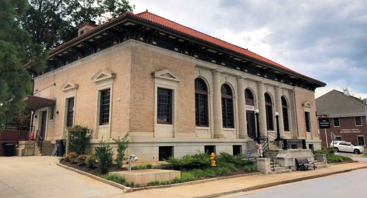
We stopped in the Old Court House, completed in 1853, to get a map and a few brochures – the historic building now houses the chamber of commerce. There, they directed us to the Newberry Museum, housed in the 1911 Federal Building and United States Post Office. The museum offers permanent and rotating exhibitions about the history of the county as well as surrounding municipalities. The Newberry Museum regularly updates its calendar of exhibits and events, so there is always something new to explore.
Newberry Arts Center
Only a few blocks from the museum is the Newberry Arts Center. Through the windows, we could see children busy creating as part of the NAC Youth Summer Camp, and the Art Center store was full of hand-made pieces by local artisans. The Arts Center also sponsors Rec Mobile Friday Art in the Park, a free, traveling activity with a local artist occurring 6 weeks of summer. Art programs are offered year-round; more information can be found on the Newberry Arts Center website.
Japanese Garden in Newberry, SC
I was pleasantly surprised that Newberry has a Japanese Garden, tucked away and just waiting to be discovered. Over the last few years, the garden has undergone renovations to help revitalize the garden. The Wells Japanese Garden is a Newberry landmark that was listed on the National Register of Historic Places in 1980. With a temple, tea garden, Moon Bridge, and Torri Gate situated amongst a natural landscape, there is a lot of culture and beauty to explore. For more on the garden, please visit the Newberry website.
Events in Newberry, SC
Newberry hosts many events throughout the year, including Oktoberfest on the first Saturday in October, a pumpkin painting party in late October, and Main Street Lights in late November; all in the charming setting of Memorial Park, opposite the Opera House. Originally the parking area for horses and carriages, on our recent visit it was transformed into an exuberant welcome to the SC7 expedition, tables set up in the shade of the enormous trees where we ate our fill of barbecue and ice cream while listening to a DJ play music.
Just around the corner, the Newberry Police Department had set up a bike rodeo, for young cyclists to test their knowledge of road signs and their skill at navigating an obstacle course. To top it off, the Opera House hosted the green carpet premiere of the SC7 documentary “Higher Ground,” and we were able to see the ornate interior of the grand building. Yes, Newberry can also throw a party!
Newberry Community Hall (left), Newberry Opera House (right)
Shopping and Restaurants in Newberry, SC
On our wanders through downtown we saw several intriguing antique stores, including one advertising “World Famous, as seen on American Pickers.” An antique bookstore, art galleries, clothing and jewelry stores round out the shopping experience – we could easily have spent a morning wandering the shops. Don’t forget the Art Center store when looking for that souvenir!
We had lunch and ice cream at family-friendly Laila’s Place, and cultural icon “Zesto’s” was on the Newberry Passage on the way into town. Several fine dining establishments catering to the Opera House crowd, and the Figaro Market was stocked full of local products and tantalizing eats.
Places to Stay in Newberry, SC
Lodging options include several of the big chains, although there are a few bed & breakfast type options in the vicinity.
Just to the south is the well-known Peak to Prosperity Passage of the Palmetto Trail, great for biking and hiking, and known for the converted rail bridge that now allows pedestrians to traverse the Broad River.
Lake Murray
Less than an hour away is Lake Murray, with all sorts of recreational opportunities. This time of year we go to see the purple martins on their way south; the thousands of birds all coming in to roost on Bomb Island at dusk is a sight to see!
Ending the Day in Newberry, SC
That evening the lights were dimmed in the Grand Opera House, and after Governor Henry McMaster gave a welcome speech, the lights were dimmed to the premiere of “Higher Ground.” We sank into our plush, red velvet chairs, and took it all in the history, the hiking, the small-town, the culture…. Yes, indeed, Newberry is one of the best small towns in America!
Are you ready to spend the day in historic Newberry, SC?
Have you checked out Blackstock Battlefield in Enoree, SC? One of the benefits of living in South Carolina is the chance to bring history to life by visiting the hundreds of historical sites across the state. We’ve visited Musgrove Mill State Historic Site many times, as it covers all the bases for my kids: Revolutionary War battlefield to explore, Tyger River trail to hike, and Horseshoe Falls to cool down in. But did you know Musgrove Mill manages a second battlefield?
Located only 7 miles to the north, Blackstock Battlefield preserves the site of the Revolutionary War battle where the infamous British Lt. Col. Tarleton was foiled in his attempt to defeat Patriot Brig. Gen. Sumter in 1780. We recently received a tour of Blackstock Battlefield during the South Carolina 7 Wonders Expedition, and wanted to share with you more on this little-known historic site just 40 minutes from Spartanburg!
Revolutionary War Action
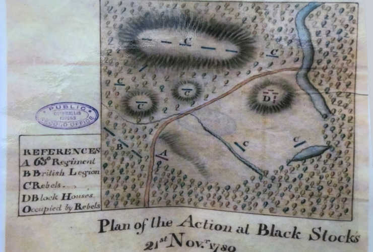
Some months after the Battle at Kings Mountain, Sumter had gathered troops in preparation to attack the British post at Ninety Six. The British summoned Tarleton from his pursuit of the “Swamp Fox” Marion down near the coast to intercept Sumter, and the British Lt. Col. managed to secretly cross the Broad with his feared Dragoons before a defector informed Sumter he was being pursued. Sumter chose to make a stand at Blackstock’s Plantation on the Tyger river as Tarleton raced towards his position with his cavalry and mounted infantry.
Historical Map of Blackstock Battlefiled
When the British caught up with Sumter, they were at a disadvantage; they had gotten ahead of their infantry and artillery in hopes of catching Sumter unawares, and instead were themselves caught in the open under heavy fire from the high ground. After suffering heavy losses and regrouping, Tarleton retreated to join his infantry and artillery – but without half of his men, who had been lost in the battle. Sumter was badly wounded, and was evacuated overnight. Tarleton pursued the Patriots for two more days, and although he claimed a victory for dispersing Sumter’s militia, it was a costly defeat for the British in that they lost numerous officers, horses, and equipment. The Battle of Blackstock’s was a precursor to the action later at Cowpens.
On Your Visit to Blackstock Battlefield
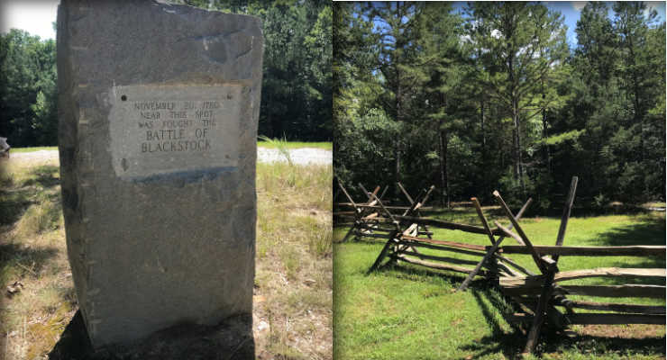
Directions: From Exit 44 on I-26, go east on SC Hwy 49 about 5.5 miles to the Blackstock’s Historical Marker. Turn left onto Blackstock’s Road, then go about 1.2 miles and turn right onto Monument Road. Continue until the pavement ends, and park in the parking area before the gate.
For the best vantage point of the battlefield, continue up the gravel road to Monument Hill. Standing with your back to the monument, Blackstock’s Ford of the Tyger River is down the hill to the right. The open meadow was much larger when the Blackstock family lived there, and the British would have come charging up the hill to meet the forces lined up along the top. On the far end of the meadow was where the house and barn were located.
Take a Hike
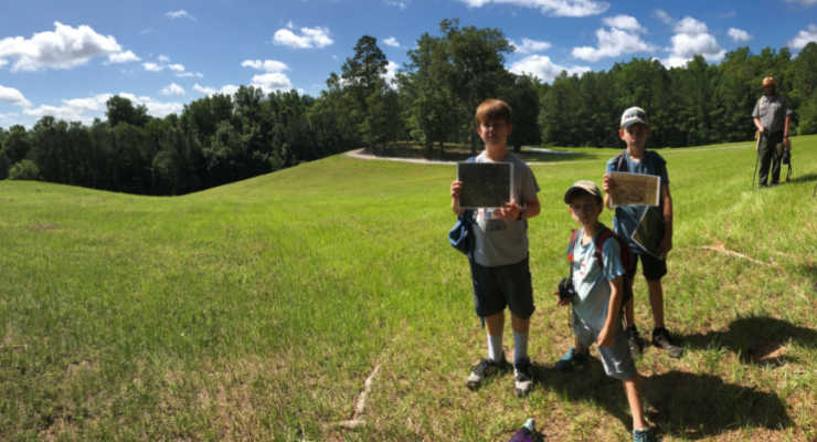
The parking area is also the trailhead for the Blackstock Battlefield Passage of the Palmetto Trail. This 1.6-mile loop descends to the Tyger River, and then follows the river for about ½ mile before climbing up to the battlefield. Skirting the edge of the open field, the trail re-enters the woods and returns to the parking area.
The SC Park Service asks that you remain on signed roads & trails while visiting the battlefield. Going off-trail can be hazardous, especially to children, as there are many deep holes from when the area was logged and the stumps were buried. On our visit, we also saw fire ants, bees, and snakes. Highlights of our hike included seeing an eastern box turtle, taking in the view from Monument Hill, and experiencing another piece of the Revolutionary War puzzle that we have been piecing together during our southeastern travels.
Things to do near Blackstock Battlefield
After hiking the Palmetto Trail Passage, my kiddos were more than happy to make the 15-minute drive to Horseshoe Falls, a small waterfall on a tributary of the Enoree River that is located in Musgrove Mill State Historic Site off Battlefield Trail. Just across the Enoree is the main portion of the State Park, including a Visitor Center and British Camp Trail. A little farther to the east is another State Historic Site, Rose Hill.
Just to the southeast is the Enoree Ranger District of Sumter National Forest. In addition to camping, cycling, OHV, fishing, horseback riding, and hunting, the Enoree is home to the Enoree Passage of the Palmetto Trail, with 36 continuous miles of trail linking Newberry, Laurens, and Union counties.
If you are headed north, towards Spartanburg, on your way home, you will pass near Glenn Springs, a small community with a lot of history, as well as by Croft State Park.
Musgrove Mill State Historic Site Admission to Musgrove Mill is $3 adults; $1.50 SC seniors; $1 children age 6-15; age 5 & younger free. Musgrove Mill is open 9 am to 6 pm daily.
Are you planning a trip to Congaree National Park in Hopkins, SC? Whether you want to kayak, canoe or hike through the old-growth forest, Congaree National Park is a fabulous adventure. With unique hiking trails for all skill levels, plus so many natural features and animals to observe, there’s something for everyone at Congaree National Park.